
Jiujiang Slate Map
I drew this map for a buyer who could not picture where his slate was coming from.
He had ordered three containers. He knew the test data — water absorption under 0.2%, flexural strength, the freeze–thaw cycles. He knew the price down to the last line. He had seen photos of the factory floor and read the production pages. But when a colleague in his office asked "where exactly is this place?", he realised he could not point to it. He had a quotation, not a map.
So I took the packing list from his order, turned it over, and drew what I will show you here. Five layers, six waypoints, one route — the geography of where Jiujiang slate is born, worked, and sent on its way. The drawing was rough. The information was not.
This is not the article that tells you what the stone is, or why it is famous, or how it is made. Those pages exist, and I will link them where they belong. This page does one thing: it puts the region on a map you can hold in your head, so that the next time someone asks you where your slate comes from, you can answer with your finger, not a URL.
The map in five layers:
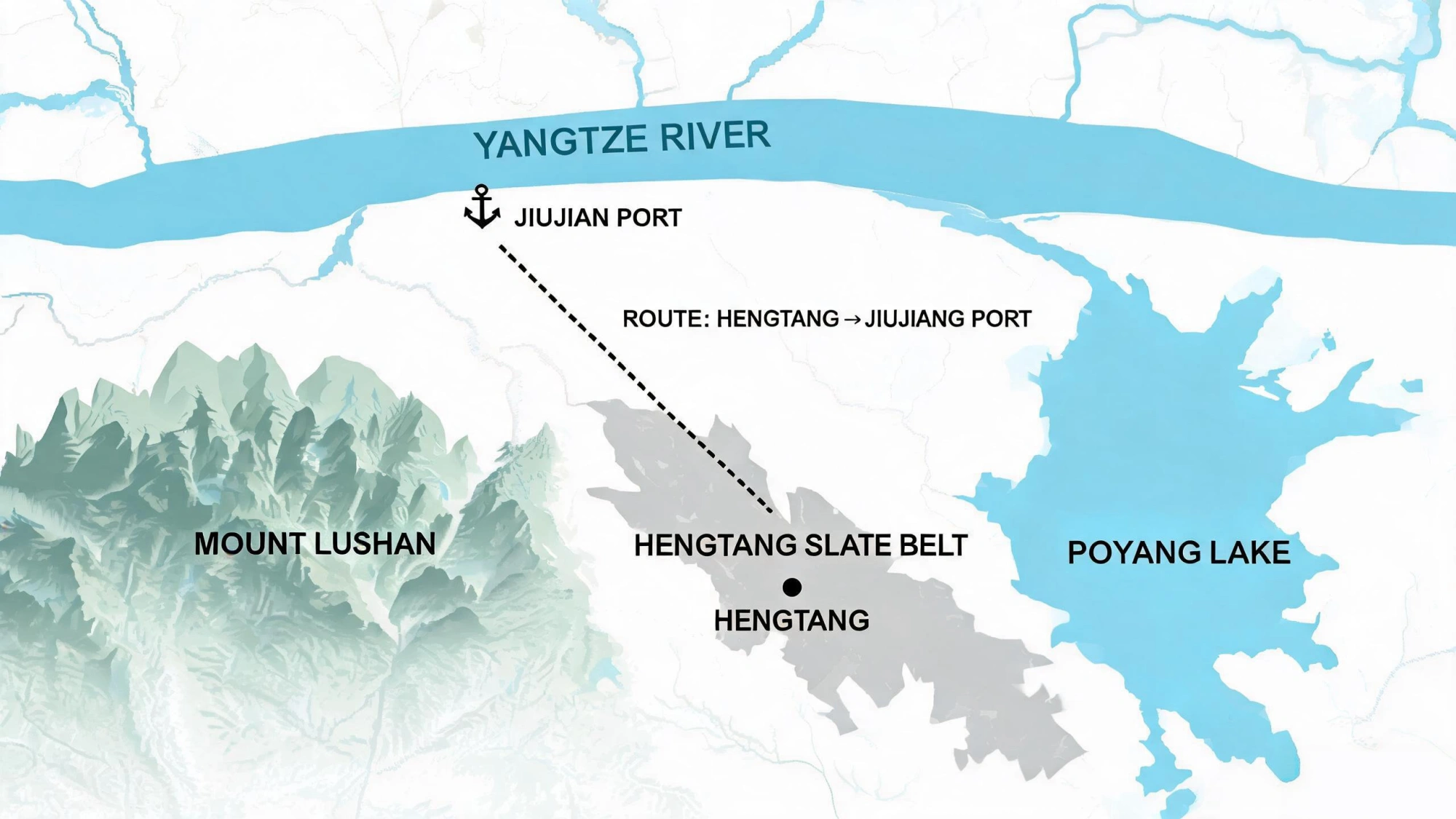
Layer 1 — The Land Frame: Lushan (mountain), Poyang Lake, the Yangtze River. Three landmarks that fix the region on any map.
Layer 2 — The Slate Belt: The quarry zone in the foothills between mountain and lake. Where the rock comes out of the ground.
Layer 3 — The Processing Corridor: Hengtang and the yards where blocks become tiles and panels. Where our factory sits.
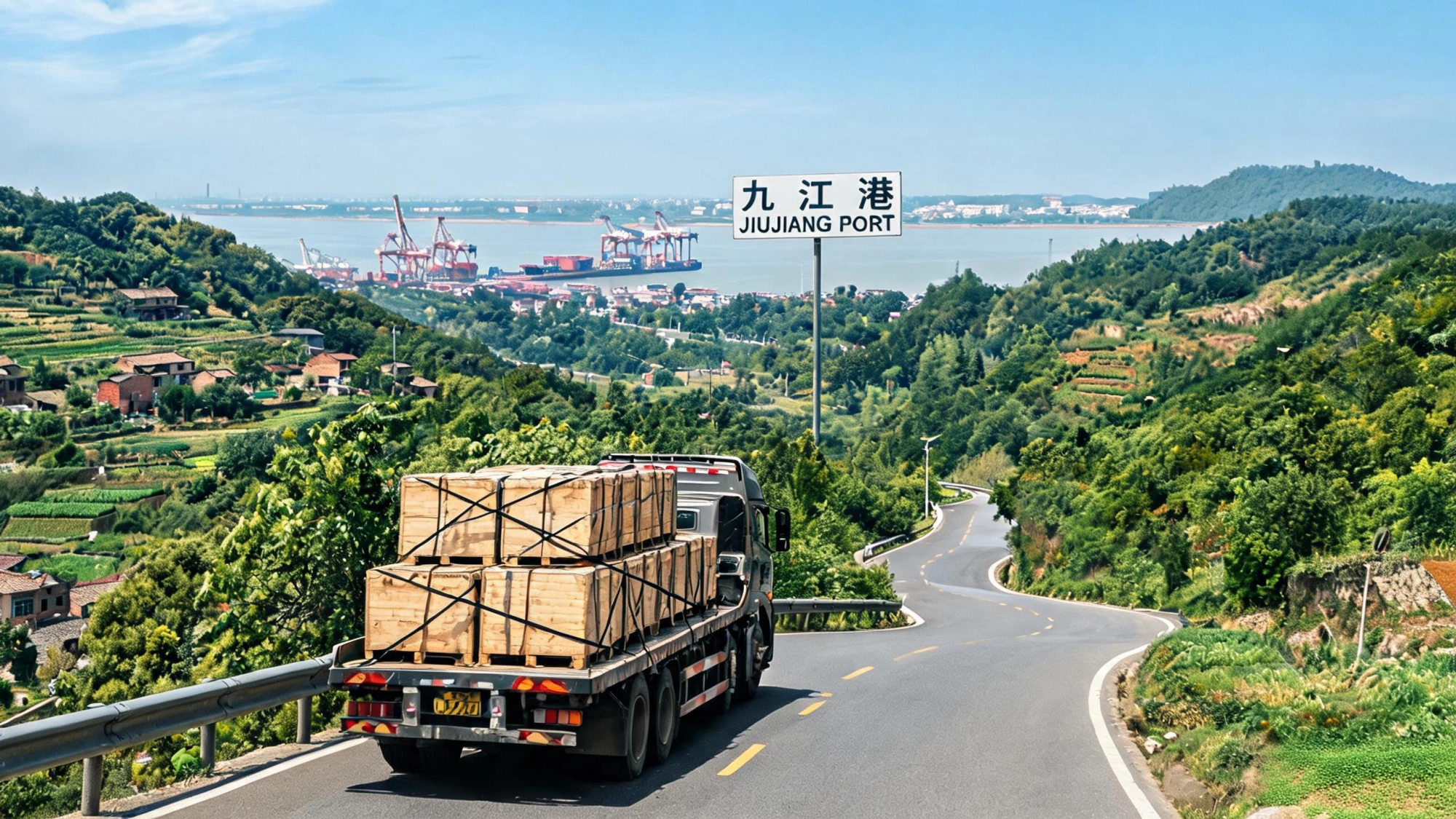
Layer 4 — The Road to Port: Factory gate to Jiujiang port, roughly 40 minutes by truck. The short chain.
Layer 5 — The River to Ocean: Jiujiang to Shanghai, about 800 km down the Yangtze. Then the sea.
Layer One: Three Landmarks, One Triangle
Open any online map and search for three names: Lushan, Poyang Lake, and Jiujiang. You will not need me to explain where they are — the map will do that. But you might need me to explain why those three, and not the town names on your quotation, are the right place to start.
Most slate regions in the world are described by their quarries. Jiujiang is better described by its geography, because the geography is what makes the region work. Three features sit close enough together that you can see the logic in one glance:
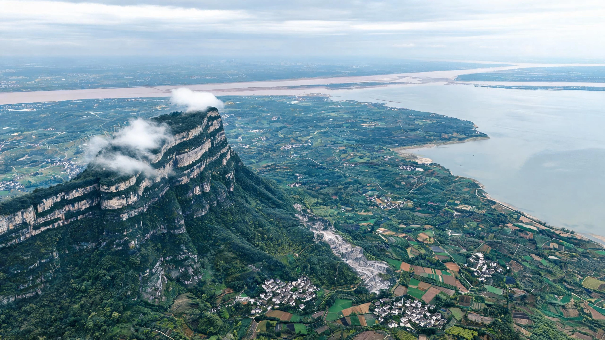
To the south, Mount Lushan — a UNESCO World Cultural Landscape and a Global Geopark, a fault-block mountain that rises from the plains to catch cloud and rain. The slate belt runs through the foothills on its flanks, not on the mountain itself, but close enough that the region has carried the mountain's name for as long as anyone has been buying stone here. If you have ever seen "Lushan slate" on a specification sheet, this is the Lushan it refers to — not a brand, a mountain.
To the east, Poyang Lake — China's largest freshwater lake, a broad, shallow basin that sits in the middle of Jiangxi Province like a hub. The lake's western shore is minutes from the slate belt; the same water system drains the hills where the quarries sit. On a satellite image, the lake is the easiest way to orient yourself — it is the largest blue shape for hundreds of kilometres in any direction.
To the north, the Yangtze River — China's great east–west waterway, running along the province's northern border. Jiujiang, the port city, sits directly on its south bank. The river is the reason heavy slate can leave this region at a price that competes: it replaces hundreds of kilometres of road with water, and water is cheaper than diesel for cargo that weighs 2.7 tonnes per cubic metre.
Draw lines between those three and you get a triangle about 40 kilometres on a side. The slate belt sits inside it. Everything else on this map — the quarries, the yards, the road, the port — is a detail inside that frame. If you remember nothing else from this page, remember the triangle. The text version of this geography walks through the same region address by address; this page gives you the shape.
Layer Two: The Belt Inside the Hills
Zoom in. Inside the triangle, the land is not flat — it is low hills, ridges and narrow valleys, the foothill country between the mountain's bulk and the lake's shore. This is where the slate belt runs, roughly northeast to southwest, following the grain of the rock.
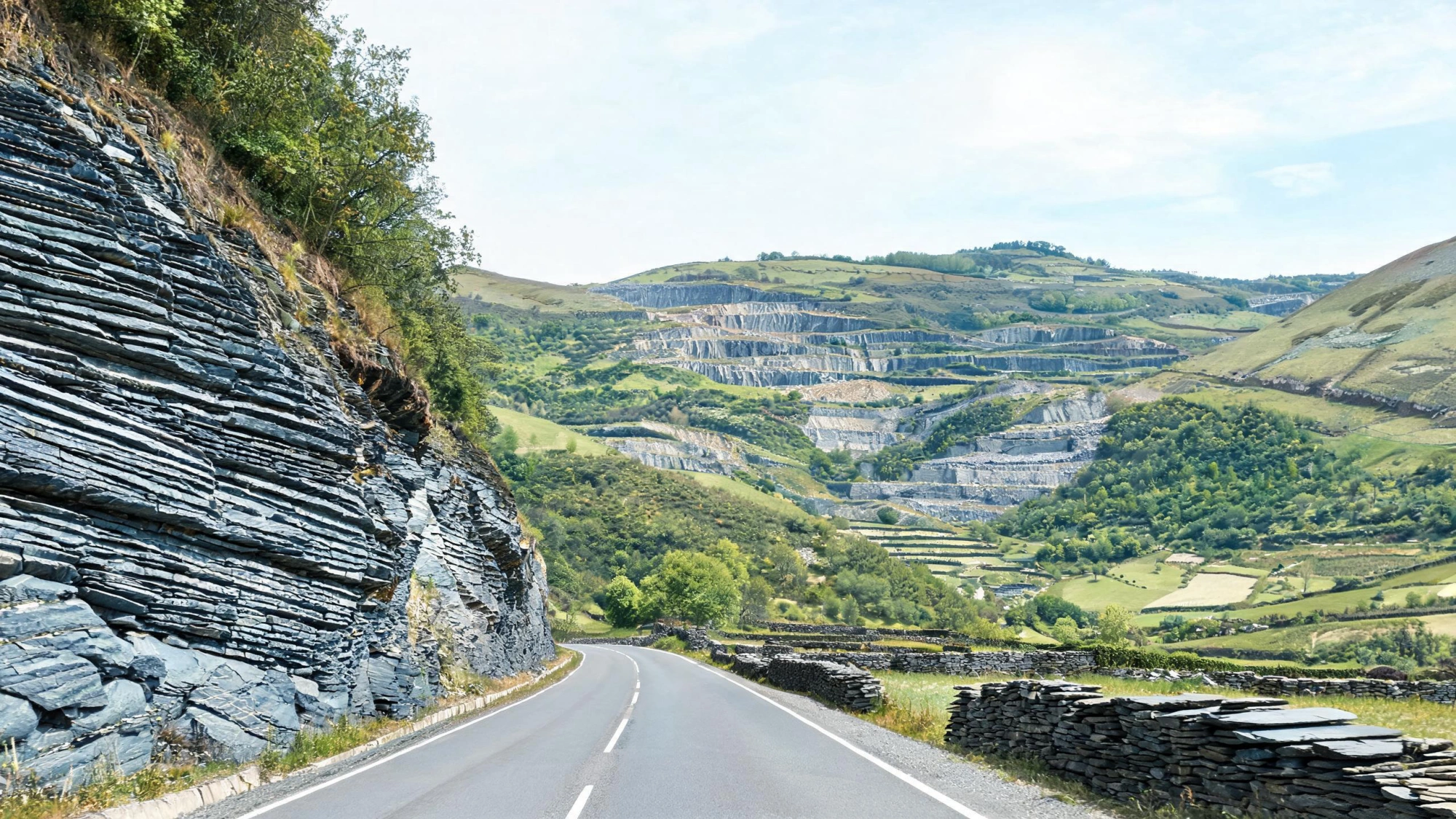
The quarries sit up small mountain roads, off the main highways. You will not see them from the expressway, and they are not signposted the way a tourist site would be. They are working operations — wire saws, bench cuts, block extraction — and access is controlled for safety and for the obvious reason that not everyone with a camera is welcome. The scale of the reserves and the geology that created them have their own pages; on this map, the point is simpler: the quarries are here, in the belt, and the belt is inside the triangle.
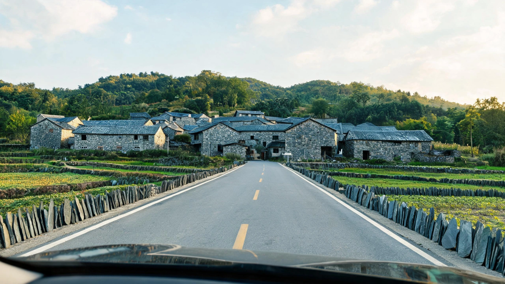
What you will see from the road, long before you reach any quarry gate, is the stone itself — in the built environment. Field boundaries built from slate slabs. Retaining walls along the road cuts, the grey-blue cleft faces still fresh after decades. Village houses with roofs of split slate, the same roofs that proved this stone's weathering resistance for generations before anyone wrote a test report. The stone is everywhere in the landscape of the belt, not because it was placed there as decoration, but because the people who live here have always used what was under their feet. If you want the long version of that story — inkstones, village roofs, the millennium of local use — the history page tells it. On the map, it means one thing: you are in the right place.
Can I find the slate quarries on Google Maps or satellite view?
You can find the region easily — Lushan, Poyang Lake and Jiujiang are all labelled on any mapping service. The quarries themselves are harder to pick out on satellite view, because they sit up small mountain roads off the main highways and are not large open-pit mines. What you can see on satellite is the belt itself: the grey-green foothill terrain between the mountain and the lake, the processing yards around Hengtang (look for cleared ground and stacked materials), and the road network connecting them to the port. If a supplier claims to operate quarries but cannot show you where on a map, that is worth noting.
Layer Three: Where the Stone Is Worked
Follow the blocks downhill. They come down from the quarry faces on short hauls — not hundreds of kilometres, but a few kilometres to the processing corridor that runs through Hengtang and the villages around it. This is where the second half of the journey happens.
Hengtang is a town in the belt, the kind of single-industry place that used to be common in stone regions everywhere. Streets that smell of rock dust after rain. Trucks stacked with rough blocks at first light. Yards where families who have worked the same beds for generations split, dress, size, and crate the stone. Our factory sits in this corridor — the address on your invoice, the gate where your container loads.
What happens here is the difference between a raw material and a product. Blocks are sorted by what they can become: the straightest, cleanest, densest material goes to the roofing lines for splitting into thin tiles; the thicker, stable material goes to billiard table beds for CNC machining. Everything is inspected — every piece, every time, the full production process from block to finished crate happens in this corridor. The map point is simple: the quarries are in the hills, the yards are in the town, and the distance between them is short enough that the stone does not need a second truck, a second warehouse, or a second pair of hands.
How far apart are the quarries and the processing yards?
Close. The quarries sit in the hills above the processing corridor, and the haul from a quarry face to a yard in Hengtang is typically a few kilometres — short enough that blocks arrive the same day they are cut. This is one of the region's structural advantages: the stone does not travel far between extraction and processing, which means less handling damage, lower transport cost, and tighter quality control. The yards and the quarries are part of the same corridor, not separate sites linked by long-distance logistics.
Layer Four: Forty Minutes to the Port
This is the layer I drew thickest on the packing-list map, because it is the layer that explains the price. From our factory gate to the container terminal at Jiujiang port is roughly 40 minutes by truck. I have driven this route over a hundred times — empty container going up, loaded container coming down, the same day, the same driver, the same seal number on the lock.
Forty minutes is not a selling point. It is a cost fact. Slate is dense — 2.7 tonnes per cubic metre, which is why it lasts a century on a roof and also why every unnecessary kilometre of road eats your margin. Most slate regions in the world are mountain-and-mule stories: beautiful geology, expensive logistics, a long chain of trucks and transfers between the quarry and the nearest deepwater port. Jiujiang got both halves of the bargain — the stone in the hills, the river port at the bottom of the road.
The pattern is simple and it does not change: an empty container comes up from the port to our gate, is loaded at the factory, and goes back down to the wharf the same afternoon. No intermediate warehouse. No third-party yard where tiles wait for their next truck. No extra hands on your stone. The container you seal at the factory in Hengtang is the container that clears customs in Jiujiang and sails from Shanghai. The full freight picture — container types, lead times, how packing standards survive an ocean crossing — has its own page. On the map, it is one line: factory to port, 40 minutes, sealed.
Why does a map matter when I am buying slate — is the test data not enough?
Test data tells you what the stone is. A map tells you whether the supplier is who they say they are. A factory that can mark its own location on a map, describe the road from its gate to the port, and tell you how many minutes it takes is a factory that is actually there. A trading company in an office tower can quote you a price and email you a test report, but it cannot draw you this map — because it does not have a gate, a yard, or a seal number. The map is not a replacement for test data; it is the first filter that tells you whether the test data is worth trusting.
Layer Five: Eight Hundred Kilometres of River
From Jiujiang port, the map stops being about roads and starts being about water. A loaded container rides the Yangtze current down to Shanghai — roughly 800 kilometres of navigable river — and from Shanghai the ocean leg begins. One river, one ocean, no re-handling of the stone in between.
Jiujiang is one of the recognised major hub ports along the Yangtze's middle-lower reaches. It is not a coastal port — it is a river port — but the river is wide and deep enough at this point for container vessels and barges to run downstream to Shanghai without transshipment. For a slate buyer, this means the domestic freight share of your landed cost is the short truck ride to the port plus the river barge to Shanghai. That is it. The heavy part of the journey, the part that would be expensive over road, happens on water.
When a supplier tells you his slate ships "from Shanghai", that is technically true — Shanghai is where the ocean vessel sails from. But the stone was born 800 river-kilometres upstream, in the hills you have just mapped. Shanghai is the gateway. Jiujiang is the door. Hengtang is the room where your order was packed.
How long does the river-to-ocean journey take from Jiujiang to Shanghai?
The river leg from Jiujiang to Shanghai typically takes a few days by barge or feeder vessel, depending on water levels and scheduling. The ocean transit time from Shanghai to your destination port depends on the route — roughly 30 to 40 days to northern Europe, 15 to 25 days to the Mediterranean, 12 to 20 days to the west coast of the Americas. Your freight forwarder can give you a precise estimate for your port and sailing schedule. The key point for planning is that the river leg is predictable and short relative to the ocean leg — most of the transit time is the ocean, not the river.
Layer Six: If You Come to See Us
Some buyers do. Over the years, buyers from different countries have flown in to walk the quarry faces, watch the splitting and CNC machining, and see their own order loaded. If you are one of them, here is the last layer on the map: the route from the airport to our gate.
The nearest major international gateway is Nanchang Changbei International Airport, about a 40-minute drive from the factory area on expressway. If you are combining a visit with other stops in China, the region is also reachable by high-speed rail via Jiujiang station. Either way, the drive takes you through the landscape you have just read about — flat farmland first, then the foothills rising, then the first slate walls and roofs appearing along the road, and finally the yards and factory buildings of the belt.
You will know you are close when the stone is in the walls. Before you reach any quarry or factory, you will pass villages where the field boundaries are slate slabs, the road cuts are grey-blue rock, and the older houses wear slate roofs that have been shedding rain since before anyone in the transaction was born. That is the belt announcing itself. We host visits by arrangement — contact us and we will plan the day.
Can I visit the quarry sites themselves, or just the factory?
Both, by arrangement. Most visiting buyers spend the morning at the factory — watching splitting, CNC machining, inspection and packing — and the afternoon at one of the quarry faces nearby, to see where the blocks come from and how the rock looks in situ. Quarry access depends on the operating schedule and safety conditions on the day, so we plan the itinerary in advance. The drive from the factory to the nearest quarry face is short. If you want to visit, write to us and we will put together a programme for your dates.
How to Read This Map
If you have made it this far, you have the whole map in your head. Here is what each layer means when it is time to make a buying decision — not as geography, but as commercial intelligence.
| Map Layer | What It Tells You | Why It Matters for Your Purchase |
|---|---|---|
| The Triangle (Lushan, Lake, River) | Three verifiable landmarks on any world map | A supplier whose region you can verify on Google Maps is a supplier with a real address, not a re-shipping label |
| The Slate Belt | The quarry zone in the foothills | Your stone comes from a known geological source — the same rock that has been tested, documented, and used for centuries |
| The Processing Corridor | Hengtang: where blocks become products | Quarry and factory are in the same corridor — no long-distance transfer, fewer hands on your stone, tighter quality control |
| The 40-Minute Road | Factory gate to river port | Short domestic haul = lower freight cost = a fully tested slate that prices competitively |
| The 800-km River | Jiujiang to Shanghai by water | Heavy cargo moves on water, not road — the domestic freight share of your landed cost stays small |
| The Visit Route | Airport to factory, about 40 minutes | You can come and see the quarry, the factory, and your order loaded — transparency you can verify in person |
That is the map. A supplier who can draw it for you is a supplier who is standing on it. The names on the belt, the reserves behind it, and the 30-plus countries it ships to all sit on top of this geography. The geography is the foundation.
Related Reading
Put the Map to Work
You have the geography. Now see what comes out of it. We will send you a hand sample cut from the belt you have just mapped — with the test data, the factory photos, and the packing list that proves the route.